

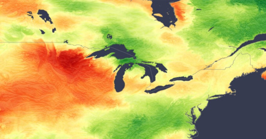
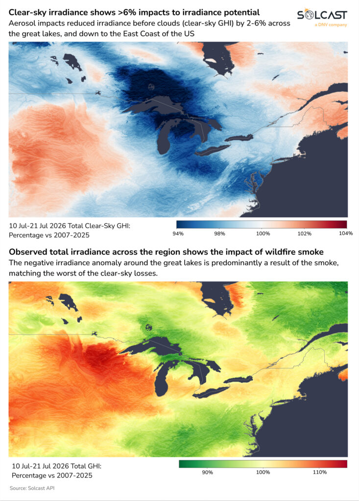
Wildfire smoke limited insolation across southern and western Ontario and the Great Lakes in mid-July, offsetting otherwise favorable high-pressure conditions. Between July 10 and 21, the GHI around the Great Lakes and into the northeastern US was up to 10% below average. A majority of this loss
was due to reduced clear-sky irradiance, which fell by more than 6% in areas, according to analysis using the Solcast API.
The result of the damped irradiation followed a rapid increase in wildfire activity in northern and northwestern Ontario. By mid-July, more than 100 fires were active, later topping 180 as Ontario’s fire danger became “extreme.” The smoke moved southeast through southern Ontario and Quebec before spreading into the Midwest and Northeastern US. Toronto, Chicago, Detroit and Minneapolis recorded some of the worst air quality in the world between July 14 and 17, while warnings were issued in more than 20 US states.
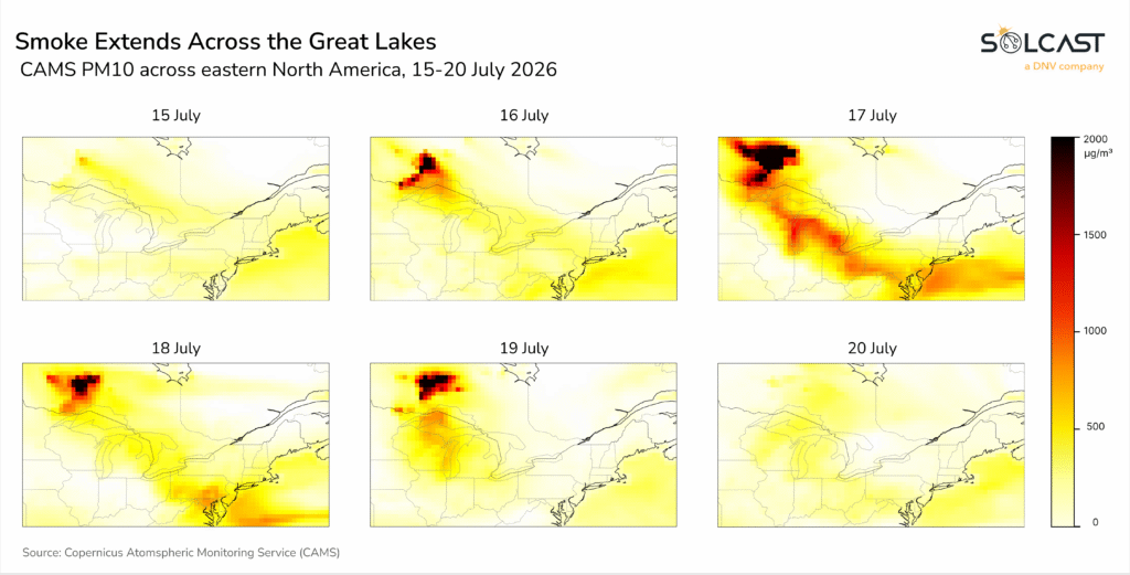
Particulate matter data (Copernicus/CAMS PM10) showed that smoke extended well beyond the source of the July 17 fires. The highest particle concentrations were over northwestern Ontario, with elevated particle concentrations continuing southeastward across the Great Lakes and toward the northeastern US.
The smoke is most clearly visible in the clear-sky radiation anomaly, where aerosols reduced available solar energy before the influence of clouds was taken into account. The observed GHI anomaly shows a similar reduction in insolation over the Great Lakes and along the US East Coast during the peak of the smoke event.
The smoke is most clearly visible in the clear-sky radiation anomaly, where aerosols reduced available solar energy before the influence of clouds was taken into account. The observed GHI anomaly shows a similar reduction in insolation over the Great Lakes and along the US East Coast during the peak of the smoke event.
Within the smoke corridor, particulate matter (PM10) concentrations over Toronto and southern Ontario remained relatively stable from July 1 to 14 before increasing abruptly on July 15 and reaching approximately three times the earlier July baseline between July 16 and 18. Concentrations then declined between July 19 and 20. Closer to the fires in northwestern Ontario, particles reached about eight times the pre-event baseline on July 17. These airborne particles attenuated incoming sunlight even when cloud cover was limited, reducing actual GHI relative to available resources under clear skies.
The combination of increased particulate matter and rain-free conditions exacerbated pollution losses. Debris accumulation increased due to the smoke particles, causing losses to increase rapidly, and these were not cleared until the much-needed rainfall occurred on July 18.
Solcast produces these figures by tracking clouds and aerosols worldwide at a resolution of 1-2 km, using proprietary satellite data AI/ML algorithms. This data is used to drive irradiance models, allowing Solcast to calculate high-resolution irradiance, with a typical deviation of less than 2%, as well as cloud tracking predictions. This data is used by more than 350 companies that manage more than 300 GW of solar energy worldwide.
